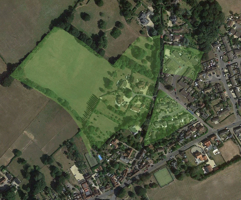
Alderstone has been described as a manor grouped around a triangular village green, this being labelled as The Green Ground in the 1842 Tithe Award [e.g. Taylor WAM 621967 p.69]. Two adjacent pieces of land were also recorded with the same name, suggesting that although the houses were indeed grouped around the triangle, the green itself was rather bigger.
The triangular part is readily identifiable as the area developed in 1975 as The Triangle and Compton House (56 on the map below). The other parts include the houses of Nunns Park (on 509) and the northern half of Ashmore Close (64), with the remainder now farm land and garden. The land parcels 56, 64 and 509 on the 1842 Tithe Award map that were labelled 'The Green Ground' are highlighted in green on the extract from the Tithe map below, while to the right is a modern aerial view overlaid with the same green highlighting.
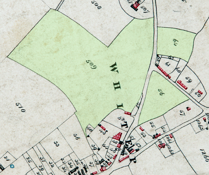
LEFT: The Green Ground in 1842 on the Tithe Award Map
RIGHT: The same areas highlighted on a modern aerial view [slight anticlockwise rotation of aerial view required]
KEY:
56: The Green Ground - now The Triangle and Compton House [check name]
64: The Green Ground - now Ashmore Close
509: The Green Ground - Nunns Orchard occupies part of this plot, the rest is still farmland and garden
In its day the Green would have functioned in much the same way as the one at Nomansland still does, with grazing animals and a degree of recreational use. In other places there are references to the the obligatory Sunday archery practice of early times, but I haven't come across such records for Whiteparish or Alderstone. There's a humorous and informative piece about these old laws in Lowering the bar" [local archived copy].